Search This Blog

Sunday, March 28, 2010

Weather Lesson


Knowing the weather is an important skill to any human being. We have been battling nature’s forces throughout our existence in this world. It surely is one factor of life that is impossible to control or even sometimes predict. It does not matter if you spend your days outside or indoors, the weather patterns are surely going to affect you in one way or another. I have lived in Lubbock, TX for almost 3 years now, and I can confess that I despise its variant weather conditions. In a town where snow, rain, and sunshine all occur in the same day, the weather has acquired great popularity in everyday conversation, good or bad.

Weather is defined as the atmospheric conditions at a specific time. A thunderstorms, hurricanes, blizzards, or even small winds are phenomena that are considered to be weather patterns. Weather is not to be confused with climate. Climate is a set of weather conditions within an area over a long period of time, such as 10-20 years. While today we might have a rainy day in Lubbock, TX, the climate for the area is considered to be semi-arid. The time of the year, geographical location, and atmospheric pressure measurements are big clues to determining the weather patterns in a region.

Lubbock’s latitude places it close to the 30° where the major deserts of the world are located. A reason for the dryness of the area relies on the energy delivered by the sun, wind patterns, and topographical patterns surrounding the Hub City. As the energy of the sun radiates towards the Earth, it arrives at different concentrations throughout the planet due to its spherical shape. The radiation concentration is higher at the equator where it arrives directly. Air in the area heats up and decreases its density. As this happens, its rises up the atmosphere and travels up and down the latitude of the earth to the 30° lines north and south. There it cools off, and drops down to the Earth. Because cold air can not hold moisture, the air that drops on Lubbock is very dry. As the air near the Earth warms up, it will absorb most of the moisture thus a reason for the arid conditions around the 30° latitude lines. The Rocky Mountains to the west block much of the moisture that travels from the Pacific Ocean. As moist air moves up a mountain, it decreases in temperature and releases its water into the west sides of the Rockies creating a rain shadow effect on the plains in the central region of the country. Lubbock is located west of the 100° west longitude line, placing it far enough from the Atlantic Ocean to miss most of the moisture and weather control it provides.

So far we have discussed the causes for the semi-arid climate found within the Texas Panhandle, but based on this information one cannot predict the weather conditions. As the northern hemisphere of the Earth is warmed up in the spring by its increased proximity to the sun, winds begin to move horizontally following similar patterns to the vertical wind currents described above. This eventually creates areas of high and low barometric pressure, the force of the weight of air against the surface of the Earth. Areas of high pressure are those where cold air condenses and accumulates within the atmosphere. Air within these areas tends to move naturally into pockets of low pressure where the air is warm , expanded and thus less dense. The warm air rises, picking up with it moisture that it transports until it is cooled enough to release the moisture and begin to descend into areas of high pressure.

You have probably have heard the meteorologist on television talking about high pressure currents, low pressure currents, and cold fronts. Well now you have an understanding of the patterns present within between the pressures, but still what happens within each? Low pressure systems are those in which warm weather and light winds are present. When a high pressure system arrives, one can expect winds, colder temperatures, and sometimes rain followed by a set of lighter winds and cold temperatures. The initial patterns of rough weather are characterized as the cold front, the border between the opposite systems.

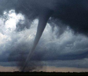
Don’t have a barometer handy to measure atmosphere pressure patterns? No worries! There is a really simple way to measure these patterns without the scientific tools that meteorologists use. One can easily track these systems by merely looking at the clouds. Cirrus stratus clouds are the light fish-scale like clouds that are found high in the atmosphere. These are the first to appear when a cold front is approaching an area, and can be seen up to a day before the arrival. Cold fronts carry mostly cumulonimbus clouds which are storm clouds that range from various patches covering the sky to a mantle. After the cold front passes, one is more likely to see cumulus clouds with are similar to the fluffy clouds we are familiar with. The presence of these in combination may vary based on the location within the cycles. However, predicting the weather can be made easy in one pays attention.

I attempted to predict the weather this last week, and found that my predictions were pretty accurate! Wednesday in class, we were blasted by strong cold winds blowing from the northwest. I could see cumulonimbus clouds cover the sky. Easy, we were experiencing a cold front. That meant that Thursday was going to be a warmer day with slow winds. Indeed, I decided to wear shorts on Thursday and was not surprised by blasting cold air. Friday was again warm, with temperatures up to the 80's. However, towards the end of the day one could see cirrus stratus clouds up high. Indeed, the weekend ended with another cold front that delivered high winds. I will not consider myself a meteorologist, still at least now I understand the excitement associated with weather predictions.

Saturday, March 20, 2010

Lubbock Lake Landmark

Last Wednesday, our class visited the Lubbock Lake Landmark in Lubbock, TX. We got the opportunity to meet Scott Trevey, the historical maintenance supervisor, who talked to us about the significance of the Landmark and the attempts to restore it to its natural state. The Landmark is an archeological and natural history preserve. Throughout its boundaries one encounters numerous archeological sites maintained by Texas Tech University since 1936 when a couple of students discovered an Indian arrow head. Since then, human artifacts have been encountered from more than 12,000 years ago. Apart from its archeological value that site also offers a great view at the natural history of the Southern Plains. The staff of the Landmark have done a great job in restoring much of the natural grasses, plants, trees, and shrubs lost during the poor management of the site by the city of Lubbock. The site has served as a dump and a recreation area for dirt bikes. Human disturbance turned it into a field saturated with invasive and overgrown native plants. Trevey told us how just ten years ago, the site was covered in mesquites. “You could not see past 10 to 20 feet,” he said, “and today look!” Indeed, as one takes a look at the site one is able to capture the sight of a developing prairie.

The control of a species that has overpopulated an area due to the lack of a predator or repressor element is indeed one of my favorite aspects of ecology. As humans, we have introduced many invasive species that over grow and eventually run out native species while changing local ecosystems. However, the Lubbock Lake Landmark was not only invaded by non-native individuals but also, and what makes this more interesting, some of its native species were able to overpopulate the area. The mesquite is native to West Texas, still it has been allowed to take over the prairies that existed (prairies usually contain short and/or tall grasses with the occasional presence of a tree or shrub). Why is this? Well that is a simple answer, the absence of fire. Fire can be considered the sheriff of the prairie. The grasses and trees evolved conjunctly with fire, making it a necessary component to the maintenance of the ecosystem. It all comes down to the location of the plant’s apical meristem, the source of growth. Grasses maintain their apical meristems underground, where they are protected from fire or grazing animals. Trees maintain their apical meristems at the tops of their branches, which exposes this crucial part to damage. Natural fires, thus controlled the spread of trees throughout the grass fields while preserving those plants who where not killed by them.

One can easily picture the Landmark’s previous condition. Surrounding private properties that are engaged in the farmland preservation program remained untouched by farmers or natural processes. Instead, the plants within the property are allowed to grow at their maximum rates. Evidently the mesquite triumphs in these properties, covering most of them in a thick forest. Walking throughout the landmark allows one to see just how damaging human existence can be when it disrupts the ordinary ecosystem development that has existed in an area for many years. It also reveals the hard work that naturalists are having to do in order to revert the damage, and bring back the native species to an area.

Sunday, March 14, 2010

Spring Break Hike


Today, my sister Diane and I went on a quest to find some birds within Franklin Mountain State Park in El Paso, TX. I am in town for spring break, and I thought it would be fun to see if we could spot some birds of prey up in the mountain. We headed up Transmountain Road, a highway that climbs up the mountain as it connects both west and east parts of town, on the search for a picnic area where we could find a trail. Unfortunately, the area surrounding the road was once used to test military ammunition and the multiple warning signs scared us away. We managed to get directions towards McKelligon Canyon, which possesses several trails. As we approach the end of the canyon by car, we are marveled by the colors and textures that the desert ecosystem provided. The light green colors and small leaves on the sage shrubs are evidence of an adaptive morphology to the harsh dry desert conditions. White limestone seems to govern the terrestrial composition throughout the trail, proof that the area we live in was once under water.


We came up to a trail that lead up to a set of caves named Aztec Caves, 1.2 miles up the mountain from the parking lot. As we hiked up the trail, we opened our ears to the sound of birds. We could hear many calls, but with no luck of a sighting. Hiking up the trail became harder the further we went. The trail got steeper with every foot we advanced, and I feared the risk of injury. We decided to climb up to the first cave, and search from that altitude for the birds we kept hearing. To our misfortune we had no luck. However, the view from the top was astonishing! One could see the evidence of small streams flowing down the mountain on those rare rainy days.


While my sister and I failed to find any of the birds we were hoping to see, I was still happy to have the opportunity to share a moment in nature with my her. Our session was different, informative, and definitely entertaining. Finding the desert beautiful is a hard task for many, but I am sure that my sibling and I share a joy for this unique ecosystem. It is home. She is a culinary student at El Paso Community College, and states that she truly enjoys seeing what I am learning in school. I indeed enjoy tasting what she learns too!

Friday, March 12, 2010

Introduction

I am creating this blog as a requirement for my Natural History and Humanities 1301 class at Texas Tech University. I am a biology major with a minor in natural history and humanities. The class concentrates around the creation of a naturalist journal. We learn the skill of birding, wild flower recognition, and the natural history of the places in which we do much of our exploration. I plan to keep this blog as a source of information regarding the natural perspectives of science. I will not only post information, but also non-fiction stories that are both informative and entertaining.
Enjoy!